
March 21 – 24, 2017

The town of Springerville is located at 6,967 feet, and it felt a lot like some parts of Colorado at that elevation, especially the wind.
I had read somewhere that there was a lava tube one could explore (a cave) in the Springerville Volcanic Field, but I couldn’t find anyone who could tell me exactly where it was and the internet failed me too. I decided to go and look for myself, but I was faced with snow melt and water soaked roads, so decided to save it for another year. I totally dread getting stuck, and at that time I didn’t have the S.O.V. on my Spot GEN3 device (which I’m testing for Bob Wells, of CheapRVLiving.com). The S.O.V. stands for Save Our Vehicle and is an add-on for the Spot personal locator beacon. It promises to come to your rescue no matter how remote you are. (We added this to my subscription in April 2017, so I now have this additional peace of mind. However, I still don’t want to get stuck).


I spent the day in Springerville catching up on internet stuff and then camped on the volcanic field, then got it into my head to drive Forest Road 300 near Show Low, which runs along the Mogollon Rim. The forest service office told me it was a nice drive and gave me directions.


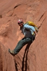
But this particular section of road 300 was not a nice drive at this time, and I think it would have been boring at the best of times. I was faced with this (see below), and after an hour or two of it I found a way out and decided to join the Mogollon Rim further west. I’d had this idea that I wanted to camp or at least stand on the edge of the Mogollon Rim ever since I’d first heard about it in a Chris Childs book, and later seen it on the map. I mean, this escarpment represents the most southern edge of the Colorado Plateau, it seemed that I couldn’t be that close without paying it homage. I simply could not take this geological feature for granted or just enjoy the views it affords. This is why I travel, to see, experience and learn.

I finally found a way to the rim and actually camped ON it for a night (part way down off the top). It looked like the edge of any number of ridges along this section, but I knew I was in a special place, and that was enough.

Further west, the rim is more defined in places.

When I drove down off the rim the next day I noticed that there was a shimmy in my steering wheel when I braked, and only when I braked. I decided to head towards Cottonwood near Sedona, and get them looked at. I’d been driving on relatively level land (not many hills or mountains) for much of the past ten weeks, so hadn’t noticed that something was wrong until I had to use them on these steep inclines. I drove off the rim, and back on it and off it again on my drive to Payson, and then onto Camp Verde near Cottonwood. I camped that night off Verde Hot Springs Road and watched a thunder storm put on a lightning show for all to enjoy. I love storms, and watched from the relative safety of my van with its many windows, as the wind rocked and the rain thundered on my roof.
I was back on familiar grounds; places I’d been before. I felt a kind of sadness knowing there were familiar roads ahead, but I also knew there was a lot of wonderful places ahead too, so I cheered myself up with thoughts of slot canyons and red rock cliffs.

I arrived in Sedona during torrential rain, and the boondocking areas were basically just mud baths, so I parked in a paved scenic view area and decided to stay the night. This other van did the same thing, and no-one bothered us.

The next morning dawned with clear blue skies, and one of the most familiar morning sights in Sedona, balloons.

I hope you have enjoyed this installment of my travels during the winter of 2016/2017, and hope you’ll continue the journey with me. Please visit the HOME page to find more articles, and feel free to share, sign up and leave a comment. Also please visit my YouTube Channel. Until next time…remember to step outside of your comfort zone as often as possible and watch it grow.
Roxy ~ A Nomad for Nature
LIKE THIS CONTENT? ENJOYING MY POSTS? HERE ARE THREE WAYS YOU CAN HELP TO SUPPORT THIS BLOG:
1. You can help to keep me fueled up by buying me a cup of coffee. It’s easy, just click the link and see how easy it is.
2. You can use this Amazon Link whenever you want to make a purchase on Amazon (or the one on my HOME page). The link is good for 24-hours only.
3. You can purchase an image, card, tote bag, t-shirt or other items from my photography store at Tranquil Light Photography.com (or share the web page on your favorite social platform).

This blog: http://NomadforNature.wordress.com/

I’m so enjoying your blog Roxy. Takes me to wonderful places. I enjoy your narration, the great photos, the focus on nature. I’m off to some wonderful places irl today. I’ll be on the road for 3 weeks so will catch up with your blog and videos (which I also love) when I can. Connectivity is not great in the woods of BC so I’ll look in when I can 😎
LikeLike